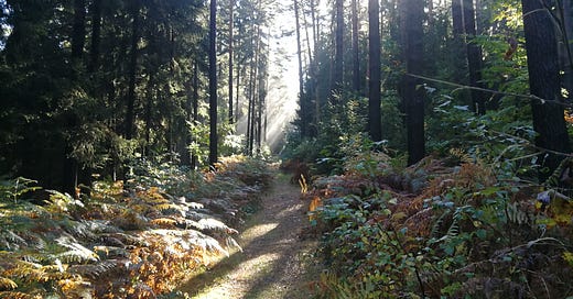
As I’ve mentioned in some of my posts, the Forststeig was one of the trails I did last year that convinced me I needed to keep long-distance hiking as a part of my life. It’s self-consciously advertised as a challenging hike, covering 104km of mountainous terrain, with over 4,000m of elevation change over its length. Some of those elevation changes climb or descend along such sheer hillsides that you need a handrail, but even the more gradual climbs will tax your legs; and doing it the way I did—running the entire length in six days, rather than the recommended seven—meant I was putting a lot of distance into each day.
When I hiked the trail last September, I was still very early in my adapting my hiking loadout, and my pack was still far too heavy: over 20kg, which meant that with every footstep, the arches of my feet were flattening out, lengthening my feet in my boots and causing my toes to bump up against the front. After only a few days of this I developed “hiker’s toe,” a common foot injury where your (usually big) toenail [content warning: body horror] will separate from the nail bed, and eventually pop off. It doesn’t really hurt, and the nail usually grows back, and it’s easily avoided by keeping your nails trimmed. I’ve now learned this lesson, but I also wanted to see if I could re-run the trail with my now-lighter hiking pack and avoid having the same problem.
The Trail
When I describe this trail as Germany/Czechia’s “premier” hiking trail, I mean that it’s the most well-appointed and high-quality trail that I’ve found in Germany. Overnights are possible either in cabins or separate bivouac sites (with the former having a wood stove and sleeping platforms, the latter sometimes no more than a covered picnic bench and some flat spaces for tents). Both are extremely well maintained, supplied with a compost toilet and a cache of water you can filter for drinking (it’s often rainwater in a large plastic barrel, so don’t drink it unfiltered or untreated unless you enjoy cholera or some other more exotic water-borne ailment), with sites offering the option for a fire also having a woodshed.
The trail was deliberately (and from my experience, successfully) designed to attract the kind of hikers who would otherwise travel to Scandinavia, where Sweden and Norway’s large network of mountain trails and shelters remain the gold standard for high-quality hiking. It also, by crossing into Czechia for a portion of the hike, provides for a decent amount of cross-border tourism. Rangers check the overnight sites every night, ask if everything’s going well or if anything’s amiss, and seem genuinely dedicated to making the trail an overall excellent hike.
Stages
My plan was to repeat the staging I did last year: starting from the southern terminus at the Schöna depot—the last rail stop along the bank of the Elbe before entering Czechia—and hiking first to the Taubenteich bivouac, then to the Autokemp pod Císařem campground at the Czech village of Ostrov, then to the Kamphütte cabin, then the Spitzstein bivouac, then the Qwirl bivouac, and then combining the last two short stages to reach Bad Schandau on the sixth day. This worked well for me last year, but a couple of the stages were twenty-two or twenty-four kilometers, which would still be a stretch on this terrain even with a lighter pack.
The first thing you do on alighting from the train is to walk straight up the hillside on a cobblestone road to the trailhead, giving you a good idea of what’s to come. From the official trailhead, you run along the side of the hills through some truly beautiful forest, with a view of the river in the valley to the left, some stone spires and cliffs on the opposite bank, and rolling climbs across streams, along cliffs, and over some smaller rises. Before long, though, you make the approach to the Zschirnstein: the first major summit of the hike. Climbing up some logging roads, you eventually turn off the main trail and head straight up the hillside for almost half a kilometer.
Once you reach it, though, the views are spectacular. Across the border into Czechia, the landscape is a mix of rolling forest hills, sharp cliffs, and spires; to the east, along the border, the mountains continue far into the distance. The Zschirnstein is a long mesa, so this is an excellent spot to stop for lunch.
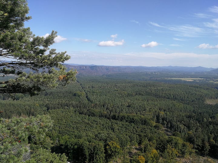
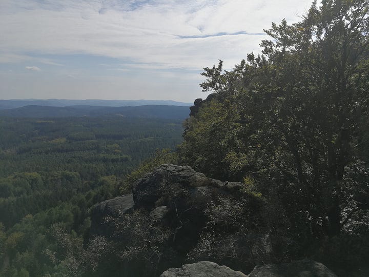
From here, you drop down to the regular forest level below, and then cross four or five steep valleys making your way to the Taubenteich. By this point last year, I was at the limit of what my legs were willing to do, but I made it to the site with no real serious fatigue. I was feeling confident that this year would go a lot easier, with far fewer problems.1
First Overnight: Taubenteich Bivouac
Taubenteich is one of the only bivouac sites with a firepit, so there is almost always a roaring campfire going in the evening, with all the hikers sitting around it for dinner, chatting. I generally stay on the edges of those kinds of gatherings because large groups of strangers can overwhelm me, but I also find there’s a certain communality that you find in these camps that’s very different from how you interact with people out in the normal world. For one, Germans universally drop the usual habit of addressing one another formally, and there’s almost no discussion whatsoever of what people do in their daily lives. The common interest in hiking is usually all we talk about (as is almost always the case, the vast majority of the conversation is about hiking gear or menu choices). For people coming from backgrounds that might be a source of misunderstanding out in the world, it’s quite refreshing to be in a self-selected circle where nobody really cares about that, and only really wants to know what tent you’re using, or where you plan to stay the next night.
This year had the added entertainment of a group of bikepackers who were staying there that night, three younger men who were making their way southward to the Swiss border. They put a bunch of stones into the firepit to heat them, transferred them into a bucket once they were hot, and then brought them into a makeshift sweat-lodge they’d made by setting up only the rainfly of one of their tents. Ten minutes later they all came stumbling out in their underwear, smoking and steaming, pouring sweat from the heat, to immediately pull on their sleeping clothes and fall into bed.
I headed out the next morning somewhat later, leaving the site by about 10:30, to climb the second major summit of the hike (and the highest peak of the trail overall), the Děčínský Sněžník. You can see the tower at the top of the peak—also a long mesa—from the Zschirnstein. Approaching it, you join with the E3, one of the European long-distance hiking trails, as it crosses west to east through northern Czechia. At the peak is a restaurant, where I deviated from the previous year’s plan by stopping for lunch. The trail after the summit is quite easy, gradually descending back into the valley, into a cross-country ski area in the neighboring forest, and then abruptly dropping down an old forest road into the valley with the campground.
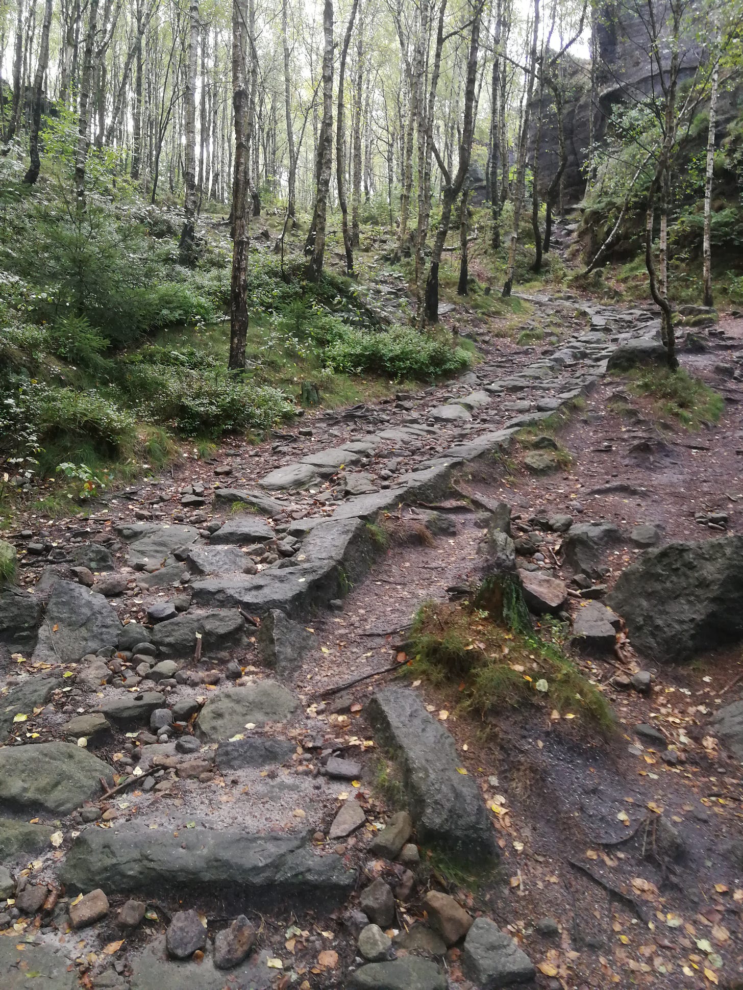
This descent is one of my favorite parts of the hike, because there’s almost no warning that the flat ground will abruptly turn downhill and drop over a hundred meters through a sharp cut, with cliffs on both sides. The road, built in the eighteenth century, is made of large black stones, at parts crumbled into ruins, winding between spires and rock faces.
Second Overnight: Autokemp pod Císařem
Arriving at the campground also gives me my only chance for a hot shower along the trail, which I always take. A notable feature of the Autokemp pod Císařem campground, prominently mentioned by signs at the registration, is that the neighboring woods are home to a fox with a shoe-stealing fetish. The office had an enormous pile of shoes recovered from the woods, along with other various pieces of camping equipment he’d also expropriated from unwary campers. When I hiked the Forststeig last year, my camp buddy for a couple of the overnights woke me up yelling, because the fox had poked his snout under her rainfly and was pulling at her shoes’ laces while she was still wearing them. He also stole her cook kit, but in the morning, heading up the hillside into the woods, she found her gear in the midst of a wide field of his other debris and booty. The fox also managed last year to pull out one of my tent stakes (he dropped it a few meters away from my tent, so it was easy to recover), so this year I made sure to drive them extra deep.
This year, a month deeper into autumn, was much colder: a winter front moving through dropped the temperature in the night to below freezing, putting frost on everything by the morning. It was beautiful waking up to it, but bitterly cold and made for slow going.
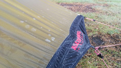

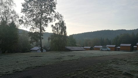
The morning sun was enough to dry everything out, but it took me a while to get everything packed again, and so I headed out around 11:00. The third day would take me back into Germany, crossing a few ridgelines and valleys, alongside farms, and finally through some expansive logging forests before arriving at Kamphütte.
Third Overnight: Kamphütte
As was the case last year, having a wood stove meant I could wash my clothes and dry them back off, so I spent much of the late afternoon doing laundry in a pail and hanging it by the stove to dry.
This also ended up being the largest group at an overnight for the trip. Along with a hiker I’d met on the first day, a group of three teenagers arrived, and then later at night a couple of older men with a dog. Everybody sat around the long tables by the fire, eating and chatting, before turning in. As on previous overnights, we all went to bed more or less shortly after sundown, which at this time of year was about 19:00.
As predicted in the weather report, it started raining in the night, and continued all through the morning until almost noon. It was here that I made my first mistake of the hike, which ended up causing a cascade of problems that ultimately caught up with me by the fifth overnight.
Rather than just toughing it out and hiking through the rain, as I had done on rainy days the previous year, the colder temperatures made me decide to wait until it had cleared up, which meant I didn’t start moving the next morning until just before noon. This stage was going to be the longest hike of the trip, at almost twenty-four kilometers, and started with a long, winding path through a labyrinth of spires and cliffs along both sides of a narrow valley. It took me almost three hours to get through them and back out to more regular terrain, and by that point I had only about three hours of daylight to cover eighteen kilometers of ground, which would have required a pace faster than I usually do even on level ground.
I did not, it turned out, make it before dark; and this ended up being both the most nerve-wracking hiking experiences I’ve had, and (oddly) one of the most beautiful.

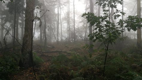
Because of the rainy morning, the forest was also now full of fog, reducing visibility to only maybe thirty meters and causing annoying glare from my headlamp. Trying to find the blazes in that kind of gloom, constantly worried that I’d missed a turn and gotten lost, slowed me down even more. At the same time, it had oddly gotten warmer in the night, and with the intense quiet of the nighttime forest, it was an intensely serene environment in which to be hiking (so long as I kept seeing blazes).2
Fourth Overnight: Spitzstein Rotstein
With the combination of all these factors, I decided to stop at Rotsteinhütte, as it was already late and the bivouac site at Spitzstein was another four kilometers down-trail. I didn’t want to risk getting lost any more than I absolutely needed to, and so I stopped here for the night. When I arrived, everybody else was already in bed and asleep, so I forewent dinner, eating just a handful of nuts and an energy ball, washed up quickly, and went straight to bed.
This was the next step in the cascade: losing four kilometers meant, should I want to reach the next overnight at Qwirl the next day, that I’d need to hike over twenty-six kilometers, through terrain that was just as difficult as the previous days. Twenty-two kilometers, the distance to Qwirl if I’d stopped at Spitzstein, was doable; twenty-six was really pushing it on this terrain, especially considering how few hours of daylight the days now had. I absolutely did not want to gamble on another night hiking in the dark, because the chance I might miss a blaze somewhere and end up lost was not something I wanted to risk.
At that point, my options would be to try to make twenty-six kilometers or stop at twenty, where there was another bivouac site at Nikolsdorf; doing that would mean I wouldn’t be able to make it to the end of the trail the day after (that would require twenty-seven kilometers on the last day, which I’d need to cover by 16:00 if I wanted to catch my train). There was a campground midway through my last stage, so I decided, with no small regret, to split the last day and arrive at the Bad Schandau train station a day later than planned.
This is where my next problem occurred: because I had missed dinner, I was now extremely hungry. Even with a lighter pack, hiking through the mountains like this burns a lot of calories, and so I really needed to eat a large breakfast. Arriving late meant I also woke up later, so started breakfast later, and so here, too, I was falling behind.
The Last Straw: Spitzstein
Once again, it was about 10:30 by the time I left Rotsteinhütte, and made my way along the ridges. The trails here pass over a number of smaller peaks, with signs detailing bits of local lore and history. The Katzstein, a small rock spire along the ridge (see below), was one of several points that would have offered a lovely view of the surrounding valleys and rivers, but the dense fog and clouds, still lingering from the previous day, kept visibility limited to maybe thirty meters.

The dense fog did, however, make the forest seem truly mystical (as one of the hikers I met next to the Katzstein described it), an almost fairy-tale setting that had me crossing through some truly enchanting scenery.
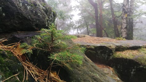
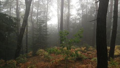
But in the end, finally, all my previous delays caught up with me. After Spitzstein, with sixteen kilometers still to go and already mid-afternoon, I realized I wasn’t going to make it before dark.
I can honestly say that standing on a trail, seeing it head off into the distance, and turning your back on it is agonizing. It’s the most painful thing I’ve had to do in the last two years. But as heartbreaking as it was, I was out of time. I headed back to Spitzstein, took a long afternoon, and the next morning headed to the nearest bus stop to take a bus to Bad Schandau to catch my train.
There are a lot of emotions tied up with that part of the story, and I’m still working my way through them. It’s going to have to be another article. For now, I woke up on my last morning on the Forststeig at Spitzstein, my very favorite of the bivouac sites; and that was, in the end, enough.
This is what is known in literary circles as “foreshadowing.”
Please don’t tell the friendly staff of the park service that I was out hiking after dark, because you’re not supposed to do that.

